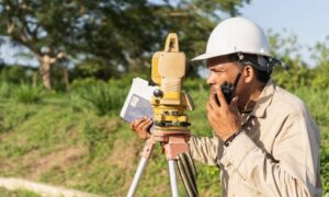
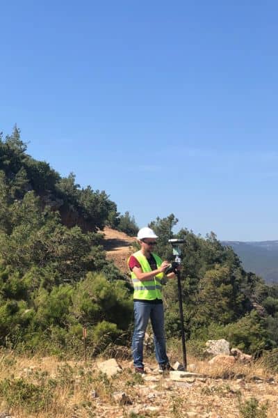
If you’ve ever ordered an ALTA survey, you already know accuracy is everything. Lenders, title companies, and attorneys expect survey results to be spot-on. Even a few inches off can create confusion about boundaries, easements, or improvements. Most of the time, surveyors depend on advanced GPS tools to get that precision. But here’s the catch: when solar storms hit, even the best equipment can struggle.
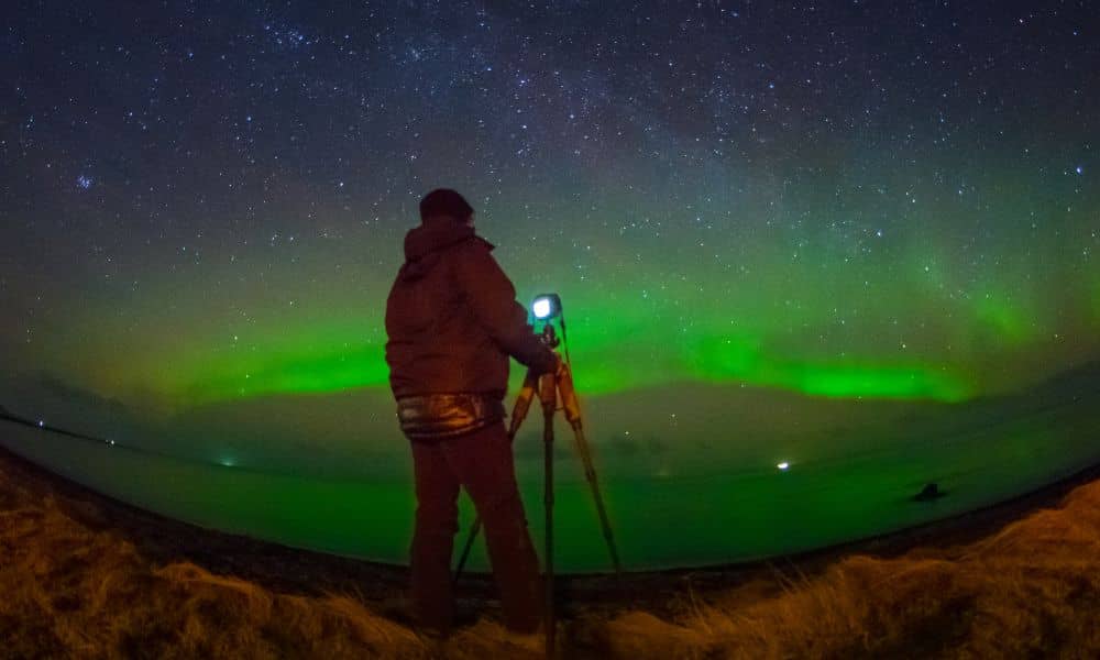
In the last few days, aurora forecasts and space-weather alerts reminded residents that the same solar activity creating beautiful skies can also interfere with satellite signals. For surveyors, those signals are the backbone of GPS and RTK (real-time kinematic) systems. When the Sun flares up, the data stream can wobble, and survey results may shift.
What Exactly Happens During a Solar Storm?
A solar storm starts when the Sun ejects charged particles that rush toward Earth. When they reach our atmosphere, they disturb the ionosphere—the part of the sky where GPS signals travel. Think of it like static on an old radio. The stronger the storm, the more “static” clogs the signal.
Scientists use the Kp index to measure storm strength. A quiet day might be Kp 2. When it jumps to Kp 5 or 6, conditions can trigger a G1 or G2 geomagnetic storm. That’s enough to create auroras visible in Wyoming—and enough to cause survey gear to drop its lock on satellites.
For everyday drivers using a phone map, this isn’t a big deal. But for surveyors chasing centimeter-level accuracy on an ALTA land title survey, that interference matters.
Why Surveys Are More Sensitive
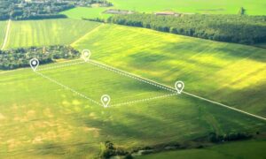
Wyoming’s wide-open spaces and rugged terrain make GPS especially important. In rangeland, energy sites, and large rural parcels, surveyors rely on RTK corrections over long distances. Those long baselines are more vulnerable when the ionosphere is shaky.
In the mountains and canyons of northwest Wyoming, sky views are already limited by slopes and tree cover. Add solar noise, and positioning can drift more than usual. When the standards of ALTA/NSPS require tight tolerances, even a small error could raise questions about the final map.
That’s why survey crews here watch space-weather forecasts as closely as they watch the weather on the ground.
How Surveyors Adapt in the Field
The good news: professional surveyors have strategies to protect accuracy when the Sun acts up.
First, they log longer sessions. If signals jump around, extra data helps smooth out the noise. They also set tighter PDOP (position dilution of precision) masks. This means their equipment ignores weak or unreliable satellites.
Second, they keep backup methods ready. If RTK positions start to wobble, they switch to total stations in open lines of sight or re-observe corners the next day when conditions calm down.
Third, they document everything. A careful surveyor notes storm conditions and records how data was checked and corrected. That way, the ALTA survey still meets the national standard, even if solar activity tried to get in the way.
What Clients Should Know
If you’re ordering an ALTA survey during a period of active space weather, it doesn’t mean you should panic. It simply means your surveyor may take extra time to confirm results. In some cases, that could add a day or two, but the trade-off is accuracy.
Think of it like waiting for clear skies to take a family photo. Sure, you could snap the picture in the rain, but wouldn’t you rather wait for a better shot? In the same way, giving surveyors time to work around solar storms ensures the final document is clean, defensible, and lender-ready.
Real-World Examples That Bring It Home
Earlier this month, NOAA’s Space Weather Prediction Center warned of possible G2 storms over North America. At the same time, Wyoming residents spotted auroras dancing across the night sky. While photographers celebrated, surveyors had to double-check their baselines.
Even beyond Wyoming, headlines showed how fragile satellite signals can be. In Europe, a government jet recently lost GPS navigation near a conflict zone due to interference. That case was jamming, not solar weather, but it proves the point: satellite signals are not invincible.
When you connect the dots, you see why surveyors treat solar activity as more than a curiosity. It’s a real factor that can influence your property survey.
Why This Matters for Your Property
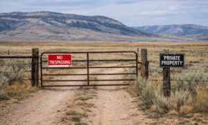
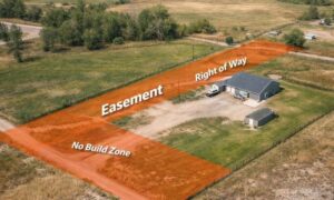
ALTA surveys are not just a map. It’s a legal safety net that shows boundaries, easements, rights-of-way, and improvements with a level of detail lenders trust. If that survey has errors, your deal can stall or even collapse.
Solar storms don’t happen every week, but when they do, they can shake the reliability of GPS gear. The difference between a rushed survey and a careful one could mean:
- Catching a hidden easement before it becomes a dispute.
- Pinpointing improvements that overlap a neighbor’s line.
- Securing lender confidence in your title insurance.
In short, waiting out a storm or double-checking data isn’t a delay—it’s protection for your investment.
What You Can Do as a Client
You don’t need to learn about geomagnetic indices to protect yourself. You only need to work with a surveyor who pays attention to them. When hiring for an ALTA survey, ask simple questions:
- Do you monitor space-weather conditions?
- How do you handle GNSS issues if a storm hits?
- Will you re-check critical corners before finalizing my map?
A professional will have clear answers and won’t hesitate to explain the process.
Also, schedule smart. If your property deal has a tight deadline, try to order your ALTA survey early. This gives your surveyor flexibility if conditions turn stormy.
Final Thoughts
Wyoming offers big skies, wide landscapes, and sometimes even northern lights. Those same skies, however, can challenge the satellite systems that surveyors depend on. A strong solar storm can nudge GNSS readings just enough to matter on a detailed ALTA survey.
The best surveyors don’t ignore this—they adapt. By logging longer, switching methods, and planning around storm windows, they deliver results you can trust. For property owners, developers, and lenders, that means peace of mind.
So the next time you see an aurora forecast, enjoy the show. And remember: while the lights dance, surveyors across Wyoming are making sure your boundaries stay rock-solid on paper.