When it comes to real estate due diligence, ALTA surveys are the gold standard for mapping easements, flood risks, and property boundaries. A recent viral story out of Rock Springs, Wyoming proves why these surveys matter more than ever.
On September 21, 2025, Rock Springs officials proposed spending $58,000 to bring in goats for flood control. The plan? Use 150 goats to graze away brush and overgrowth along Killpecker and Bitter Creek, reducing flood risk by clearing drainage channels.
The move sparked fierce debate. Critics slammed the cost and questioned its effectiveness, while supporters argued goats were safer than heavy machinery in tight riparian zones. Whether you call it clever or crazy, “Goat-Gate” went viral across Wyoming media — and it carries surprising lessons for property owners who rely on ALTA surveys.
Why Casper Needs ALTA Surveys to Address Flood Risks
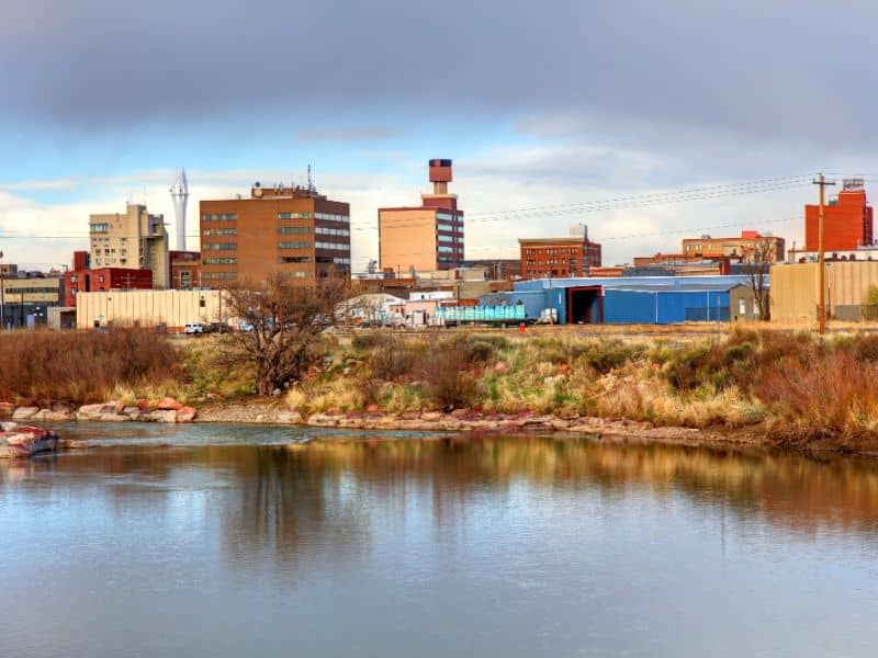
Casper and broader Natrona County are no strangers to seasonal flooding. Heavy summer storms and spring snowmelt along the North Platte River, Cole Creek, and adjacent drainages routinely test the city’s infrastructure.
In fact, the National Weather Service Riverton office flagged Natrona County just this week for possible heavy rain and localized flooding in low-lying areas. Even if large floods are infrequent, drainage corridors remain a hidden risk for property buyers and lenders.
The Rock Springs goat story may seem far removed from Casper’s real estate market. But it highlights the cost of ignoring vegetation, easements, and maintenance rights — exactly the elements that a well-scoped ALTA survey should capture.
ALTA Surveys & Flood Risk: Practical Tie-Ins
Here’s how the goat controversy translates into practical due diligence in Casper real estate.
1. Vegetation and Channel Mapping
Under Section 5 fieldwork requirements, surveyors must show visible evidence of water features and drainage improvements. In practice, this means more than sketching a creek line. In flood-prone Casper sites, attorneys should request:
- Brush boundaries along banks
- Debris dams or sedimentation bars
- Signs of erosion or recent high-water marks
These features don’t always show in title documents but can materially affect insurance and buildability.
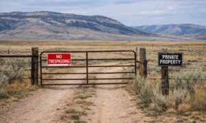
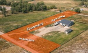
2. Drainage Easements and Maintenance Rights
Many recorded drainage easements in Natrona County only grant a right “to drain” but not the right “to maintain.” The Rock Springs story illustrates the danger: without explicit rights to clear vegetation, owners may face disputes about who pays for upkeep.
Checklist for Casper deals:
- Confirm Schedule B includes drainage easements with maintenance rights.
- Verify any channel realignment agreements with the City of Casper or county.
- Flag missing or vague easement language for attorney review.
3. Table A Items That Matter Most
Casper buyers, lenders, and surveyors should negotiate Table A items with flood and drainage risk in mind:
- 11(a): Include evidence of stormwater and drainage utilities, not just gas, water, or electric.
- 19: Off-site easements treated as fee for mapping — critical if a stormwater pipe crosses neighboring property.
- Custom 20: Wetlands were removed from Table A in the 2021 update, but if HUD, FHA, or an agency requires it, negotiate a custom note.
4. Elevation & Floodplain Profiles
Don’t settle for FEMA floodplain overlays alone. Ask surveyors to document channel invert elevations, overbank zones, and bench profiles. These cross-sections show whether a corridor has capacity or is at risk of overtopping during events.
Casper Mini-Checklist: Post-Storm ALTA Deliverables
To keep it simple, here’s a Casper-focused checklist attorneys and lenders can use:
| Item | Why It Matters | ALTA Request |
| Brush / Shrub Lines | Overgrowth worsens floods | Require field notes on vegetation |
| Drainage Easements | “Drain” vs. “Maintain” rights | Confirm in Schedule B |
| Stormwater Utilities | Often overlooked | Include in Table A 11(a) |
| Off-Site Conveyances | Pipes crossing neighbors | Add Table A 19 |
| Wetlands / Riparian Soils | Still relevant for agencies | Negotiate custom Item 20 |
| Channel Elevations | Shows drainage capacity | Ask for profiles and invert elevations |
The Bigger Lesson: Due Diligence Beats Headlines
Rock Springs’ goat controversy will fade, but the lesson remains: ignoring flood corridors costs money. Whether vegetation is cleared by goats, machines, or not at all, Casper property buyers must ensure surveys properly capture drainage realities.
When a lender sees “ALTA/NSPS 2021 Land Title Survey,” they assume the property’s hidden flood liabilities are revealed. That only happens if attorneys and surveyors push for the right Table A items, easement checks, and field observations.
Conclusion: Goats, Floods, and Smarter Surveys
The goat story in Rock Springs is quirky, but the message for Casper’s real estate world is serious. Flood corridors don’t manage themselves, and vegetation, drainage rights, and easement clarity can make or break a property deal.
Whether you’re a lender, attorney, or buyer, demand more than the bare minimum. Use ALTA/NSPS surveys with the right Table A items as your defense against costly surprises — and let the goats stay in the headlines, not your closing table.
FAQs
1. Do ALTA surveys automatically show floodplains?
Not exactly. FEMA flood maps can be overlaid, but you must request it. Elevation checks are usually an optional Table A item.
2. Why were wetlands removed from Table A in 2021?
The ALTA/NSPS committee determined wetlands delineation is not a surveying task. But clients can negotiate a custom Item 20 if required.
3. How do goats tie into survey work?
The goat debate is about vegetation in flood corridors. ALTA surveys should show visible vegetation and easement maintenance rights to clarify responsibility.
4. What Casper creeks pose the most risk?
Cole Creek, Garden Creek, and low-lying parcels along the North Platte River are common hotspots for drainage and flood concerns.
5. Who pays if a drainage easement doesn’t include maintenance rights?
Without explicit language, disputes arise. It could fall to the landowner, HOA, or municipality — which is why confirming easement terms matters.
6. How often should flood features be re-surveyed?
Best practice: after major storm events (6–12 months) or before refinancing, to ensure current conditions match recorded documents.