How To Find Your Property On FEMA’s Flood Insurance Rate Maps

What are FEMA flood maps?

FEMA’s Flood Insurance Rate Maps (FIRMs) or just Flood Maps are provided after a flood risk assessment has been completed or updated for a community.  This study is known as a Flood Insurance Study.  The FIRM gives you the Base Flood Elevations (BFEs) and insurance risk zones in addition to floodplain boundaries.  The FIRM may also show a delineation of the regulatory floodway.

Once the “insurance risk zone”  (commonly referred to as the flood zone) is determined, actuarial rates, based on these risk zones, are then applied for newly constructed, substantially approved, and substantially damaged buildings.  FEMA uses these rates to determine the insurance rate you will pay for flood insurance

FEMA’s Digital Flood Maps

FEMA discontinued the production and distribution of paper flood maps in 2009 as part of its Digital Vision Initiative. This affected all the Flood Maps, boundary information, and study reports. However, clients can still view the products for free through their website or buy them in digital format.

To view these flood maps online, go to FEMA’s Map Service Center and key in your address (hi-lited area shown here) search for your home.  This will prompt you to then select the map that covers your area.  The Flood Maps are somewhat cumbersome to use online. It is best to go through the tutorial on the bottom right of the address search page for an easier and more effective use of the GIS map.
More Posts

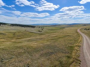
Subdivision survey for recording a new lot in Wyoming, showing open grassland, rolling hills, and a winding gravel access road.
land surveying
Surveyor

Subdivision Survey Steps Before Recording a New Lot

You’re ready to sell five acres off the back of your land, and a buyer is lined up. Then the title company says the new lot can’t be insured until a plat is recorded. That’s when many owners learn that splitting land takes more than a handshake and a deed.

Read More »
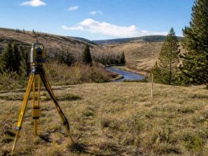
Yellow surveying total station and elevation rod measuring ground levels on a grassy homesite near a river in Wyoming for flood elevation assessment.
flood damage
Surveyor

Flood Elevation Survey for a New Home Site

The best spot for a new house is often decided by a number most buyers never see. That number is the height of expected floodwater compared to the height of the ground. On a lot near a creek, river, or low draw, a difference of one or two feet can

Read More »
Aerial view of a large commercial property with office buildings, parking areas, access roads, and surrounding development
alta survey
Surveyor

When an ALTA Survey Is Needed for a Commercial Loan Assumption

You’ve found a commercial property, and the seller’s mortgage can transfer to you. Taking over that loan may let you keep the existing rate and terms. Then the lender’s checklist arrives, and an ALTA survey sits on it. In most deals, the lender or the title company decides whether you

Read More »
Raised residential home with an elevated foundation and stairs, illustrating the type of structure documented by a FEMA elevation certificate
flood damage
Surveyor

FEMA Elevation Certificate After Raising a Home

When you raise a house, you change the height of its lowest floor. Flood officials and insurers care about that number more than any other. Once the lift is done, your old FEMA elevation certificate shows a house that isn’t there anymore. A new certificate fixes that. It records your

Read More »
Aerial view of a rural homesite with open fields, access roads, and nearby ponds, illustrating site conditions to consider when planning a perc test
land surveying
Surveyor

Perc Test Planning for a Rural Home Site

You found a rural lot, and now someone says you need a perc test before you can plan a septic system. That test matters, but it works best once you have a rough idea of where the house, driveway and well will go. A perc test measures how fast water

Read More »
Two-story suburban home with a driveway, front yard, and fence, a typical setting for a residential survey
land surveying
Surveyor

When a Residential Survey Helps Before a Major Renovation

A big renovation changes more than the inside of a house. Additions, bigger footprints, new garages, and second stories all change how a home sits on its lot. They can also change how close a home sits to the property line. A residential survey gives homeowners clear, current measurements of

Read More »