The fight over gravel mining near Casper Mountain in Wyoming has been in the news a lot lately. Residents, local leaders, and a mining company are in a legal battle over whether a gravel pit should be built near homes and parks. This fight shows why anyone building on land needs clear information before starting work. One of the best ways to get that information is with an alta survey, especially before any construction begins.
The Casper Mountain story is about knowing what is really on the land and what rules apply. People worry about water, dust, trucks, animals, and whether the land can be used as planned. These worries show why it is important to fully understand the land. An alta survey helps with this.
What’s Happening at Casper Mountain?
Earlier this year, a judge allowed a developer to challenge decisions that had rejected mining leases near Casper Mountain. The case went back to state officials for more review, and residents are still worried about how the mining could affect water, air, and the neighborhood.
This kind of situation shows how quickly land development can get complicated. People were surprised when the leases were approved with little notice, and lawsuits followed. When there’s so much uncertainty, the safest step for anyone planning to build is to get a clear picture of the property first. That’s why many developers start by ordering an alta survey. It helps them know exactly where the property lines are, what easements exist, and any legal restrictions, so they can move forward without unexpected problems.
What Is an ALTA Survey?
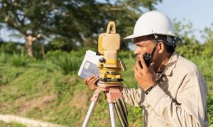
Before starting any big property project, it helps to get a clear picture of the land. That’s where understanding an alta survey comes in. Essentially, an ALTA survey is a very detailed look at a property. It doesn’t just measure the land — it also checks legal records to make sure you know exactly what you’re dealing with.
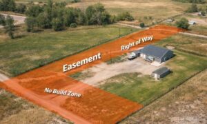
With an ALTA survey, you can see property boundaries clearly, spot any buildings or paved areas, know where utility lines run, and understand easements that might affect your plans. By combining what’s physically on the land with the legal rights tied to it, an ALTA survey removes guesswork and helps you make smart decisions before building, buying, or arranging financing.
Why the Casper Mountain Conflict Shows the Need for an ALTA Survey
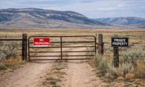
The Casper Mountain fight shows that unclear boundaries and land rights can slow or stop a project. When rules are not clear and neighbors are upset, the risk for developers goes up. An alta survey makes sure property lines are correct, easements are shown, and possible problems are found before work starts.
Banks and title companies often require an alta survey before they give a loan or insurance. It gives everyone proof of the land’s boundaries and rights. Using an alta survey early saves time, money, and worry.
What Makes an ALTA Survey Different
Not all surveys are the same. Some just show rough property lines. Others do not check legal records. An alta survey does both.
It shows exactly what is on the land and what legal rights are attached to it. This helps prevent disputes with neighbors or government officials. It also helps developers follow rules and avoid delays.
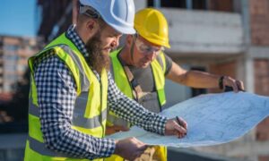
How Developers Can Use an ALTA Survey
If you plan to develop land near Casper or similar areas, starting with an alta survey is smart. Working with a licensed land surveyor makes sure the survey is correct and complete. Doing the survey early lets developers use the information in their plans, talk clearly with lenders and lawyers, and avoid surprises later.
Sharing the survey results with everyone involved — planners, contractors, and legal teams — keeps everyone on the same page. This builds confidence and prevents mistakes that could stop a project.
Why Prospective Clients Should Care
The Casper Mountain fight shows how land issues can grow into big disputes. Even simple projects can face problems if property boundaries and rights are unclear. An alta survey gives developers, buyers, and lenders a clear understanding of the land so they can make good decisions.
Starting with an alta survey makes projects less likely to have delays, fights, or extra costs. Developers can plan and build with confidence, knowing the land is fully understood.
Conclusion
The Casper Mountain gravel mining fight shows how confusing land issues can cause big problems. Whether you are a developer, buyer, or lender, you need clear information before starting a project.
An alta survey gives clear property lines, easements, and improvements. It provides confidence to everyone involved, lowers risks, and helps projects start on solid ground. In cases like Casper, an alta survey is not just helpful — it is essential.