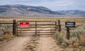
Cheyenne used to feel like a quiet place for land deals. That’s changing fast. Large tech companies are buying big pieces of land, and new projects keep showing up. Data centers need space, power, water, and room to grow. Because of that, buyers now look at land in a very different way.
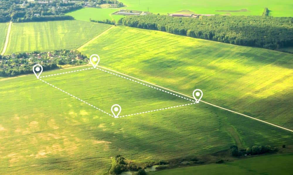
A simple lot is no longer enough. Many projects need several parcels combined into one site. That sounds easy on paper. In real life, it can get messy.
This is where an ALTA title survey starts to matter a lot more, especially in a fast-moving market like Cheyenne.
Big Land Deals Bring New Problems
When land gets sold in small pieces over many years, each piece has its own history. One parcel may come from an old farm. Another may come from a split lot. A third might have changed hands many times.
Now imagine putting all those together into one project.
Lines don’t always match. Descriptions don’t always agree. Maps can show one thing, while the ground shows another.
At first glance, everything looks fine. Then the details start to show up.
That’s where things slow down.
When Parcels Don’t Line Up
Buyers often think nearby parcels will fit together without a problem. Sometimes that’s true. Other times, it’s not.
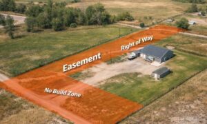
A small gap between two parcels can leave a strip of land no one can use. An overlap can raise questions about ownership. Even a few inches off can disrupt a building layout.
Most of these issues come from old legal descriptions, many of which were written long before modern tools. Some rely on landmarks that no longer exist, while others use measurements that don’t match today’s mapping.
So even if two parcels sit side by side, their legal lines may not align. That’s usually when these problems start to show up, including hidden parcel conflicts an ALTA title survey can reveal, often after plans are already in motion.
When land values are high and timelines are tight, small mistakes can turn into real problems.
Land That Works Alone May Not Work Together
A single parcel may look fine on its own. It has space, shape, and access. It checks all the boxes.
Now combine it with another parcel next to it.
Suddenly, the layout changes. The shape may no longer fit the project. A boundary line might cut through where a building should go. The site may lose usable space.
Developers don’t just buy land. They buy how that land works as a whole.
If the pieces don’t fit, the plan falls apart.
Growth Brings Pressure on Land Use in Cheyenne
Cheyenne’s growth is pushing more land into active planning. Areas that once sat outside city limits now face new rules. Boundaries that seemed simple before now sit inside larger plans.
That shift can affect how parcels connect. It can also change how lines get used during development.
Buyers may think they are getting a clear, open site. After a closer look, the land may have limits they didn’t expect.
Those limits don’t show up in a quick review.
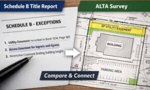
Where an ALTA Title Survey Steps In
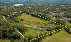
An ALTA title survey helps bring all the pieces together.
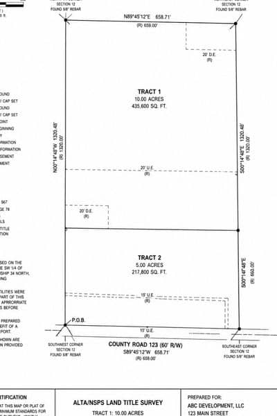
It compares the legal descriptions with what’s actually on the ground. It shows how parcels relate to each other. It points out gaps, overlaps, and conflicts.
More than that, it helps turn scattered records into one clear picture. It also helps verify boundaries across multiple parcels before plans move forward.
That clarity matters when you’re working with large land deals in Cheyenne. You need to see how everything connects before moving forward.
Without that view, you’re guessing.
A Situation Many Buyers Face
A buyer finds a great location in Cheyenne. The land sits in a strong growth area. Several parcels sit next to each other, and together they look perfect for a large project.
The deal moves forward.
Then the survey comes in.
One boundary line cuts slightly into the next parcel. There’s a narrow strip that no one can fully claim. The layout for the project needs to shift. Space gets lost.
The buyer now faces a choice. Change the design, adjust the deal, or walk away.
All of that could have been seen earlier with a properly reviewed ALTA title survey.
Fast Deals Leave Less Room for Mistakes
Land in Cheyenne is moving faster than before. Buyers compete for the same sites. Sellers want quick decisions.
That pace creates pressure.
It’s easy to move forward based on surface details. The map looks clean. The parcels sit together. Everything seems fine.
But small issues don’t stay small. When projects get large, even tiny problems can grow into major costs.
Speed without clarity leads to trouble.
A Smarter Way to Look at Land
Buyers need to shift how they think about land in fast-growth areas like Cheyenne.
Don’t assume nearby parcels fit together. Don’t rely on old maps alone. Don’t treat each parcel as separate if the plan is to use them as one.
Look at the full site early.
Check how the pieces connect. Confirm the lines match. Make sure the land works as a single unit.
That step can save time, money, and stress later.
Cheyenne Is Changing, and So Is the Risk
The data center boom is bringing new energy to Cheyenne. It’s also raising the stakes for anyone buying land.
Larger deals mean more moving parts. More moving parts mean more chances for things to go wrong.
An ALTA title survey helps bring order to that complexity. It gives buyers a clear view before they commit.
If you’re looking at land in Cheyenne, it’s worth getting a clear picture of how those parcels actually fit together before moving forward.
And in a market like this, clarity is hard to beat.