
If you’ve ever ordered an ALTA title survey, you know it’s not just a simple property map. It’s the most detailed survey in the industry, combining boundaries, easements, improvements, and title records into one report. Lenders, attorneys, and buyers all rely on it to make million-dollar decisions. Because the standards are strict, surveyors face real challenges in the field. And some of those frustrations have been trending online lately—showing what happens when reality collides with expectations.
When Drone Maps Leave Blank Spots
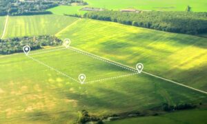
Surveyors are using drones more often to speed up data collection. It’s a powerful tool, but it isn’t flawless. Recently, surveyors shared problems with aerial images that came back with missing patches. Imagine reviewing a property map and seeing big white holes where information should be.
These gaps usually happen because the drone didn’t capture enough overlapping photos. Strong winds, poor lighting, or a shaky flight path can also cause blurred shots that software rejects. Without overlap and clarity, the program stitching the photos together fills the space with nothing.
For a property owner or developer, those gaps are more than a technical glitch. They can hide encroachments, missed easements, or small structures that matter to lenders and insurers. A hole in your aerial map could translate into a hole in your due diligence.
How do professionals fix it? They plan drone flights with at least 70–80% photo overlap, use ground control points for accuracy, and supplement aerial shots with on-the-ground checks. That way, nothing critical slips through. When your surveyor delivers an ALTA title survey that includes drone data, ask how they checked for gaps. A thorough crew will be ready with an answer.
The Problem of Scope Creep
Another frustration that surfaced online is scope creep. This happens when a client asks for more than what the survey was meant to cover. One recent example: a property owner wanted a proposed consolidation drawn directly on the ALTA map.
Here’s the issue: the ALTA/NSPS standards define exactly what belongs in the survey. Consolidation plans, future building footprints, or zoning overlays are not part of the standard deliverable. They are separate exhibits that require more time, research, and cost.
When scope creep sneaks in, surveyors face pressure to bend the rules or deliver extras without proper agreements. That may sound harmless, but it can create confusion, delay closing, or even raise liability issues if the added information isn’t fully verified.
For clients, the fix is simple but important: ask early, and expect clarity on scope. If you need extras, like consolidation maps or subdivision layouts, a professional surveyor will prepare them as separate documents. The ALTA title survey should stay clean, consistent, and compliant with the national standard. That way, every party—lender, attorney, and title insurer—can trust the final product.
When Boundary Pins Are Disturbed
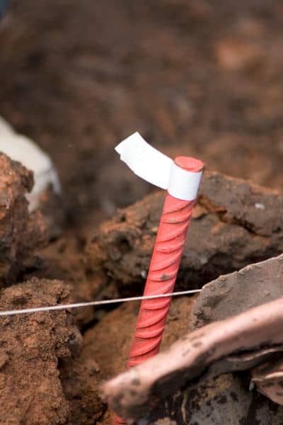
One common challenge in land surveys is tampered or disturbed boundary pins. In one case, a surveyor discovered that a neighbor had moved an iron pin, raising questions about the true property line.
Boundary pins, or monuments, mark corners and tie field evidence to legal records. If one is missing, bent, or replaced, the boundary becomes uncertain. On an ALTA title survey, even a single shifted pin can put a deal at risk.
Surveyors don’t rely on the pin alone. They review past records, deeds, and nearby evidence like fences or trees. If a pin proves unreliable, they re-establish the corner using standard methods and document the process, often in a Record of Survey.
For buyers, this documentation is critical. ALTA title surveys not only show the boundaries but also explain how problems were resolved—helping prevent disputes and giving lenders confidence.
Why These Challenges Matter to You
Drone gaps, scope creep, and tampered pins may sound like inside-baseball problems, but they directly affect your risk as a property owner, buyer, or developer. An incomplete drone map can miss costly encroachments. Scope creep can delay closing or add confusion to legal records. A moved pin can spark boundary disputes that drag on for years.
The value of an ALTA title survey lies in how it handles these messy realities. Surveyors trained in ALTA/NSPS standards know how to document problems, explain them clearly, and deliver a report that lenders and attorneys can rely on. In other words, the challenge isn’t whether issues pop up—it’s whether they get handled the right way.
What You Can Do as a Client
You don’t need to be a surveyor to protect yourself. You only need to know what to expect. When you order an ALTA title survey, ask your surveyor:
- How do you check drone data for completeness?
- What extras are included in the base ALTA, and what requires a separate exhibit?
- How do you handle disturbed or missing boundary pins?
A good surveyor will have ready answers. If they hesitate or brush off your questions, consider it a red flag.
Final Thoughts
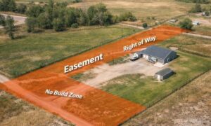
The ALTA title survey is often the backbone of a property transaction. It confirms boundaries, reveals easements, and aligns the title record with the land itself. But behind every clean map are real challenges—gaps in drone data, creeping scope requests, and tampered monuments—that surveyors deal with daily.
By understanding these field challenges, you’ll see why hiring a skilled, detail-oriented surveyor matters so much. It’s not about getting a piece of paper; it’s about making sure your investment stands on accurate, defensible ground.