Why You SHOULD Have a Land Survey Completed Before Purchasing Land?

Buying land, whether commercial or residential, is always an expensive endeavor, even if prices have eased somewhat lately. This is why finding a piece of land that you like and making an offer for it without conducting a land survey on the area is possibly the biggest mistake that you can make.

Here’s why it’s very important that you have land surveying done first:

Land surveyors can determine if you’re actually getting what you’re going to pay for. This means find out whether the sidewalks, trees, driveways and even the bird bath is part of the property you’re about to buy. Land surveying would also determine whether the neighbors are encroaching into the property, which would then mean you’re going to have problems in the future with your neighbors.
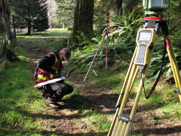
Land SurveyHiring a lamand surveyor doesn’t only mean they determine what you’re getting or not getting – land surveyors are the experts, and they can help with building regulations, wetland regulations, etc. Take note that these regulations can change anytime, but land surveyors should be updated on these regulations, or they will refer you to someone who is.

What if the current landowner (the one selling the land) can provide you with old land survey documents? You should still hire your own land surveyor to see if the boundary monuments are still in place. Also, land surveying done a few years back may not show recent changes to the land. If the existing survey is older than about ten years, you should get a whole new survey. Technology and surveying standards are both a lot better now and should provide you more confidence in the survey work.

Second, that survey was completed for that owner. He may have instructed the surveyor not to show certain things on the drawing. At least have a land surveyor go out and review the parcel with this survey in hand. We have seen numerous cases where a new land survey would save the buyer thousands so don’t become a victim.

I’ve heard a lot of people say hiring a land surveyor is nothing but unnecessary expense. I’ll tell you what’s unnecessary: the stress caused by paying thousands of dollars for something and ending up not getting what you were expecting. If you are smart, you’d hire a certified land surveyor before making any land purchases.

More Posts

Drone survey of gravel and soil stockpiles at an active construction site in Wyoming
drone surveying
Surveyor

When a Drone Survey Helps Document Construction Stockpiles

Contractors move a lot of material during a single project. Dirt piles grow and shrink week to week on many job sites. A drone survey gives you a clear record of stockpile size and shape without walking every pile with a tape measure. Documenting Stockpile Volumes Before a Construction Project

Read More »
Drone survey and land survey methods used to map Wyoming terrain with aerial and ground surveying equipment
land surveying
Surveyor

What’s the Difference Between a Drone Survey and a Land Survey?

A drone survey and a land survey answer different questions. One looks at the ground from the air. The other measures points on the ground itself. In Wyoming, where properties can run for thousands of acres and terrain changes fast, knowing which one you need saves time and money. A

Read More »
A licensed land surveyor measuring the elevation of a Wyoming home to prepare an elevation certificate for flood insurance
flood damage
Surveyor

Do You Need an Elevation Certificate for Flood Insurance?

If you own property, you may have heard the term “elevation certificate” while shopping for flood insurance. It sounds official, and it is. Most people don’t know what it does or when they need one. Here’s a plain answer: you don’t always need one. It depends on your property, your

Read More »
A drone survey captures a large ranch with rolling hills, fence lines, stock ponds, and mountain foothills
land surveying
Surveyor

When Large Acreage Projects Call For a Drone Survey

Wyoming ranches don’t measure land in feet. They measure it in miles. A boundary that takes twenty minutes to walk on a small lot can take three days to walk across an open range parcel. That gap is exactly why more landowners, ranchers, and energy developers turn to a drone

Read More »
Metal property survey pin with a pink survey flag marking a residential property corner while a homeowner mows the lawn in the background
land surveying
Surveyor

What Survey Stakes and Pins on Your Property Actually Mean

You’re mowing the back corner of your lot. The blade catches something. You stop, dig around, and find a metal cap sticking two inches out of the ground with a strange stamp on it. Most people just shrug and mow around it. But that little marker is doing more legal

Read More »
Surveyor and engineer reviewing a topographic survey with contour lines on a development site before grading and construction
topographic surveying
Surveyor

When Your Development Project Needs a Topographic Survey

Every development project starts with a question. What does this land actually look like? Not the legal lines on a plat map. The real shape of the ground. The slopes, the low points, the drainage paths, the trees and structures already there. That’s what a topographic survey shows you. If

Read More »