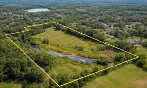

Something important is happening in Cheyenne. The City Council delayed a vote on adding some land to the city. This land includes farms and other parcels near the city limits. Even though it might sound like city politics, it really matters if you’re buying or developing commercial property. When the vote is delayed, it can affect property deals, loans, and approvals. That’s why many property owners turn to an alta land title survey.
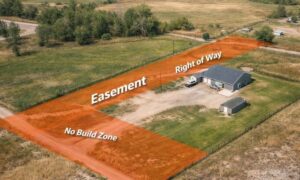
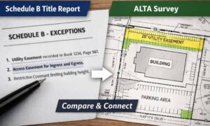
This type of survey doesn’t just show property lines. It also makes it clear where easements, rights of way, or other restrictions exist. If you want to understand exactly what an alta land title survey covers and why it can save you headaches later, you can learn more about ALTA land title surveys. It’s a simple step that gives both buyers and lenders a clear picture of the property before any deal moves forward.
The Impact of Cheyenne’s Annexation Delay
The postponed vote leaves some properties in uncertainty. Buyers and developers aren’t always sure how the land might be used in the future, and the rules for building, permits, and zoning could change once the council makes a decision.
All of this can make financing trickier. Banks want to know exactly what they’re lending on, and if there’s any doubt about boundaries or legal rights, they may delay or even deny a mortgage. That’s why many buyers choose to protect their investment with an ALTA survey. It gives a clear picture of the property, showing exactly where the lines are and any easements or rights of way that could affect the land. Knowing this upfront makes it easier for both buyers and lenders to feel confident moving forward.
Why Boundaries Matter More During Uncertainty
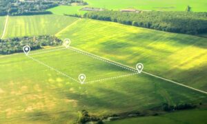
Property lines are very important when buying land. When annexation is delayed, city limits might change, and boundaries can become unclear. Fences, driveways, or utility lines may cross into city land.
An alta land title survey shows exactly where the property lines are. It also shows easements and any encroachments. This helps buyers and lenders understand the land fully and avoid problems. Without it, mistakes can cost time and money and slow down the deal.
How an ALTA Land Title Survey Protects Your Investment

An alta land title survey does more than show boundaries. It shows easements, rights of way, and any legal interests in the property. In areas with pending annexation, the survey gives confidence that your property is understood before you buy.
For developers, it helps prevent delays in permits or connecting to city services. For lenders, it reduces risk and ensures financing can move forward. An alta land title survey acts as protection against surprises that annexation delays can bring.
What Happens Without a Survey
If you skip an alta land title survey, you might face serious problems. Property lines may be wrong, easements may be missed, and encroachments may go unnoticed. These issues can lead to disputes, delays, and extra costs.
Having the survey early gives a clear picture of the land. Buyers and lenders know what they are getting. This makes it easier to plan for future changes and move forward safely.
Timing Your ALTA Land Title Survey
The best time to get an alta land title survey is early in the buying process. This gives you time to check the results, fix any problems, and work with your lender. Waiting until the last minute can cause stress and delays.
In Cheyenne, with annexation decisions still pending, ordering the survey early is even smarter. It shows the true boundaries and rights of the property, helping you make good decisions even before the city vote is final.
Conclusion
Cheyenne’s annexation delays show how uncertainty can affect commercial property deals. When city rules and land lines might change, buyers, developers, and lenders face extra risk.
An alta land title survey gives clarity. It confirms boundaries, easements, and legal rights before a deal closes. For anyone planning to invest in commercial property, getting this survey early is the safest way to protect your investment and keep your project on track.