You find a piece of land near Casper. It looks perfect. There’s a dirt road leading right to it. You picture a home, maybe a shop, maybe a place to get away from everything. Then something unexpected comes up. You don’t have the legal right to use that road. This kind of problem shows up more often than people think. It even happens on land tied to the Bureau of Land Management near Casper. Some parcels look open and easy to reach, but they have no legal access at all. That’s where an alta land survey starts to matter. It gives you a clearer picture of the property, especially when you look at what an alta land survey shows about access, so you’re not just relying on what you see during a visit.
The Road You See May Not Be Yours
At first, everything feels simple. You drive up, walk around, and follow a clear path. It’s easy to assume the road comes with the land.
But that’s not always the case.
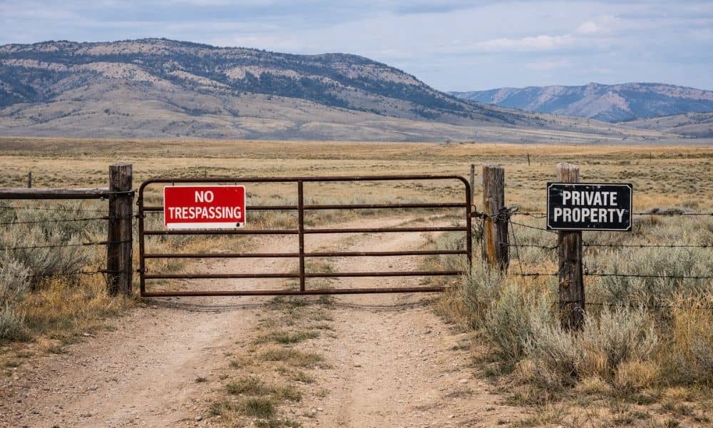
A road can sit on someone else’s property. It might have been used for years without ever being recorded. It can even look public but still belong to a private owner.
Because of that, the path you take during a visit may not be one you can legally use later.
So even if the land feels open and easy to reach, the legal side can tell a very different story.
Why Buyers Miss This Problem
Most buyers focus on the land itself. They look at size, shape, and location. Access feels like a given, so it rarely gets much attention.
Sellers don’t always spell it out either. A listing might show a road leading in, but it won’t always say who owns it or who’s allowed to use it.
In rural areas like Casper, this happens even more. Land gets split over time, and people simply use whatever path is there. Years pass, and no one really checks the paperwork.
Then a new buyer steps in and expects everything to work the same way. That’s usually when the problem shows up. It’s often only after checking an alta land survey before you buy that people realize the access they saw isn’t actually tied to the property.
What an ALTA Land Survey Shows About Access
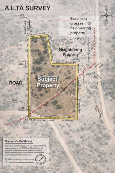
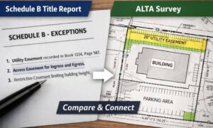
An alta land survey helps connect what you see with what exists in the records.
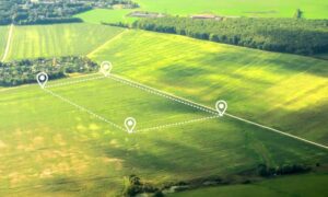
It shows how the property sits in relation to nearby land. It also looks at how you enter and leave, and whether the route you plan to use is legally supported.
Instead of guessing, you get a clear answer.
For example, the survey can show if the road crosses into another parcel. It can point out when access depends on an agreement. It can also reveal when the path you walked doesn’t match what’s tied to the property.
That kind of detail matters before you commit to buying.
When a Property Looks Reachable but Isn’t
Some properties sit behind others with no direct link to a public road. Others rely on paths that were never recorded. In both cases, the land can look usable at first glance.
Then the issue shows up later.
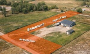
You may find that your only way in goes through someone else’s land. You may learn that the path has no legal backing. You may even depend on a neighbor who can change their mind at any time.
At that point, the land you bought becomes difficult to use.
That surprises many buyers because nothing looked wrong during the visit. The problem stays hidden until someone checks the details.
Why This Matters in Casper
Casper and nearby areas have a mix of open land and private ownership. That mix often leads to unclear access.
Large parcels get divided over time. Some keep road access, while others lose it. Old paths stay in place, even when no one updates the records.
Because of that, it’s easy to assume access exists when it doesn’t.
Local buyers and investors run into this more often than they expect. The land looks wide open, yet the legal way in is missing.
What Happens If You Don’t Check
Skipping this step can lead to real problems.
You might end up owning land you can’t reach without crossing someone else’s property. You could face disputes if a neighbor blocks the route. You may even spend time and money trying to fix something that should have been clear from the start.
In some cases, the property loses value because access isn’t secure.
All of this starts from one simple assumption: the road you saw must be yours to use.
Seeing the Property the Right Way
When you visit land, take a moment to think about how you got there. Look at the path you used. Ask where it starts and where it goes.
Then check if that path is actually tied to the property in a clear way.
An alta land survey helps answer that question. It connects what you see on the ground with what exists in the records, so you’re not relying on guesswork.
Before You Move Forward
Buying land should feel exciting, not uncertain.
Before you move ahead, make sure the access you see is the access you actually have. Don’t assume the road belongs to the property. Don’t assume long-term use means legal use.
Check it the right way.
An alta land survey gives you that clarity. It helps you understand not just where the land sits, but whether you can truly use it the way you plan.
Because in the end, owning land only works if you can actually get to it.