
When you are planning to buy land or property, one thing you should never ignore is the alta survey. This type of survey does more than draw boundary lines. It helps protect you from hidden legal troubles. Recently, a land title scam went viral online, drawing attention because people were arrested for selling land with fake titles — and many buyers were almost tricked into losing a lot of money.
Even though that scam happened abroad, it shows a big lesson we all should learn: title fraud is real, and anyone buying property needs solid protection. In this article, we’ll talk about what happened, why it matters, and how a proper ALTA survey can help protect you — especially here in Casper, Wyoming.
What Was the Viral Title Fraud Story?
In the scam, four people were caught trying to sell land with fake ownership documents. They allegedly used forged land titles to get money from buyers and investors. The fraud was uncovered when a buyer realized the title was fake and contacted authorities.
Other cases have shown similar fraud: land being sold without consent of the real owners or fake documents being used to trick buyers into paying large sums of money. Although this example was far away, the danger is universal. Title fraud doesn’t only happen overseas. Scammers often target vacant land or properties that look easy to sell online.
Why Title Fraud Matters to Buyers
You might think, “That happened far away. It won’t happen here.” But title fraud isn’t limited to one country.
Even in the U.S., scammers focus on vacant properties or parcels of land because no one is watching them closely. These bad actors forge deeds or file fake claims to make it look like they own land. Then they sell it to unsuspecting buyers — sometimes for big money.
Even if you are buying property here, you could fall victim to similar scams if you don’t check the title carefully. This can happen especially with rural land, commercial parcels, or lots that are not well monitored.
What Is Title Fraud
Title fraud happens when someone tries to sell or transfer land they don’t actually own by using forged deeds or fake documents. They may pretend to be the owner, or use improper identity records to make the title look real.
In some cases:
- Fake sellers show a copy of a title that looks genuine.
- Scammers file fake documents with the registry or county office.
- Buyers only discover the fraud after closing the deal.
This kind of fraud can destroy trust, cost you money, and leave you with no legal ownership, even if you thought you bought the land fairly.
How an ALTA Survey Helps You
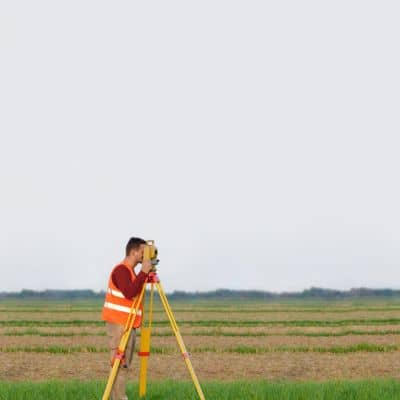
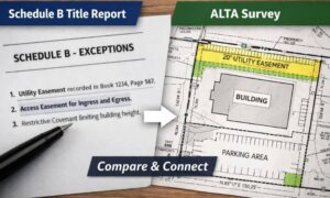
An ALTA survey does more than just show where your property lines are. It is a detailed, standardized survey that combines boundary work with legal title information and historical data. This type of survey is what lenders and title companies rely on before closing a deal.
It helps protect you in three ways:
Helps Title Companies Feel Confident: Title insurers want to know something is right before they guarantee a policy. A clean ALTA survey reassures them that nothing is hidden or risky with the land. This can make it easier to get loans, mortgages, and title insurance — all without last‑minute surprises.
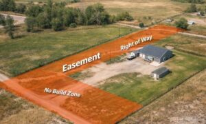
Confirms What’s Really on Record: A good surveyor doesn’t just look at a paper deed. They check county records, title data, easements, access roads, and rights of way. They compare what is recorded with what exists on the ground. This means they can spot inconsistencies early — before you sign anything.
Detects Red Flags Early: A survey can uncover warning signs like mismatched title and property records, missing easements, unclear access rights, or conflicting ownership claims. These issues might be invisible if you only trust the seller’s documents.
Why You Should Think Like a Smart Buyer
Even if your deal seems “clean,” you should always assume someone could make mistakes — or worse, try to commit fraud.
Vacant land is most often targeted by title scammers because owners don’t monitor it closely. Courts and experts note that buyers who fail to check the title carefully cannot always claim they acted “in good faith.”
Although these examples can come from outside Casper, they reflect a universal truth: buyers need more than trust—they need solid proof. Many buyers protect themselves by arranging property verification for buyers, ensuring that every ownership record and easement is double-checked before they commit.
How This Applies to Buyers
Here in Casper, Wyoming, many land deals involve commercial parcels, vacant lots, development land, or investment properties. These kinds of properties are often not occupied and don’t have a resident owner watching them. That makes them more vulnerable to title issues. Without a careful survey, you might miss unrecorded access rights, unknown easements, incorrect owner names, or previous claims that never show up in simple searches.
An ALTA survey doesn’t just protect you. It protects the lending and closing process too. Title insurance companies often require an ALTA survey before they give you full coverage.
Final Thoughts
Buying land should be exciting, not stressful. But title fraud can turn a good deal into a nightmare if you walk in unprotected.
The viral news story about fake titles reminds us of one thing: looks can be deceiving. Even official documents can be forged, and even buyers who think they’re careful can be blindsided.
That’s why an alta survey matters. It gives you real, checked‑and‑verified information about the property you want to own. It helps title companies trust your transaction. Most importantly, it protects your money, your time, and your peace of mind.
So before you close any deal — whether for land, commercial property, or investment parcels — make sure you have an ALTA survey in place. It is more than a map. It’s your safeguard against fraud.